From Chembra to Andharban, Western Ghat treks capture the mountains through forests, grasslands, wildlife, and mist
The Western Ghats, vast and ancient, are one of India’s richest ecological regions. Trekking across the sprawling ranges offers a variety mediated through changing textures, grasslands, ridges, and forests. Together, they make the strongest possible case for the Western Ghats as a nature-first trekking region.
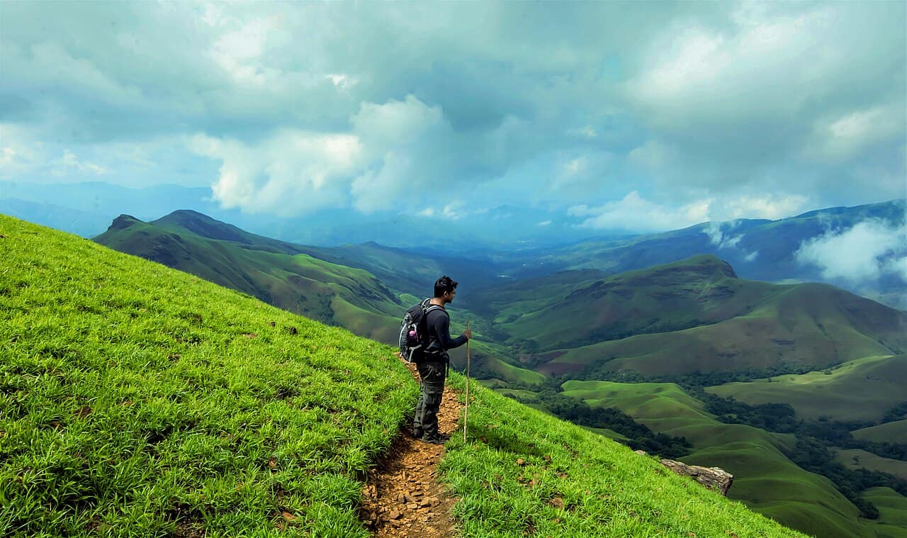
Chembra Peak: the iconic Wayanad climb
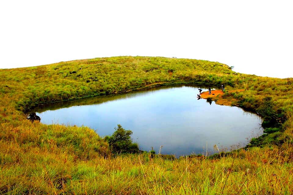
Rising to 2,100 metres, Chembra Peak is the best-known trekking name in Wayanad and is known for its Hridaya Saras, the heart-shaped lake towards the end of the route. Trekkers usually drive up to a parking and watchtower area before the walking section begins, and the section beyond the lake is now restricted because of wildlife activity, bringing the active trek to around 3 to 3.5 km, taking roughly 45 minutes.
Chebara is beyond welcoming to beginners, but it is still steep enough in sections to raise the pulse, especially when the grass is wet and the soil soft; even then, it is more approachable than the longer, more punishing treks elsewhere in this list. Chembara must be considered an easy to moderate difficulty immersive experience rather than a day of serious trekking.
The trek begins in tea country, lower slopes which slowly give way to open grass, rolling ridges and the lake itself, which has become one of Kerala travel’s most recognisable images. It is a trek that delivers quickly. You do not need a whole mountain day to feel the shift from settlement to upland. The views over Wayanad can be generous on a clear morning, and even when mist hangs low, the landscape keeps its drama.
Bird and animal life are part of that atmosphere, even if sightings are never guaranteed. The broader Wayanad wildlife landscape supports rich birdlife, and Kerala Tourism lists species in the area such as the Malabar whistling thrush, Malabar trogon, Malabar grey hornbill, paradise flycatcher, and other forest-edge birds. The present restriction beyond the lake is itself a reminder that this is not a domesticated hill but a wildlife-sensitive mountain zone. Chembra may be one of the more accessible treks here, but the wild is still close.
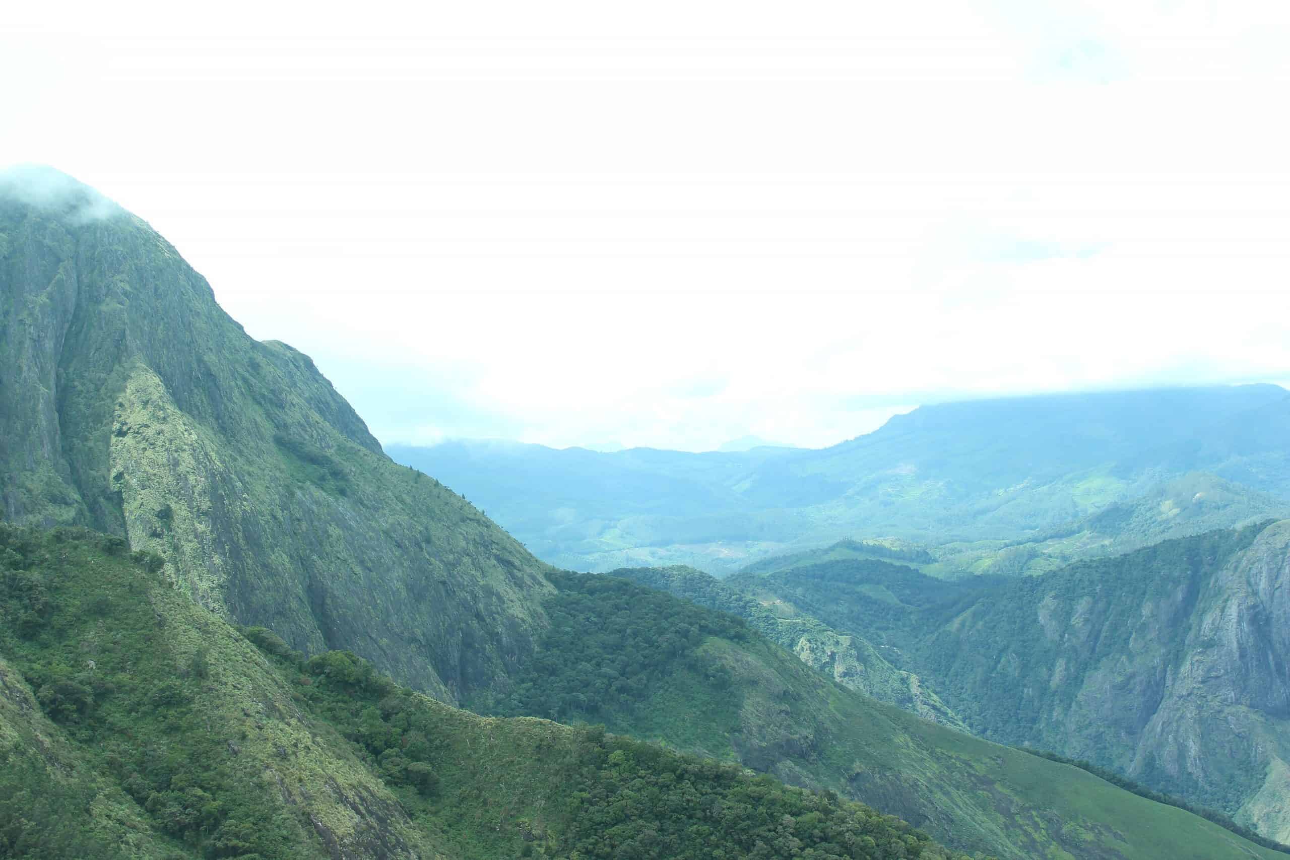
Brahmagiri: a quieter world of forest and meadow
Rising to around 1,608 metres, the peak sits within the Brahmagiri Wildlife Sanctuary, known for its evergreen forest, mist-heavy valleys, and a route linked with Iruppu Falls. It is also one of the few treks in this set that feels genuinely quieter in reputation than it deserves to be. Bhrahmagiri is not photogenic, but what it lacks in social media-ready photo options, it more than makes up for with the rich experience it offers the trekkers.
Brahmagiri can be safely categorised as having moderate to hard in terms of difficulty. The trek has a 10 km approach to the peak with a final steep push, which can be quite the test of endurance.
Wildlife is one of Brahmagiri’s great strengths. Karnataka Tourism notes that the sanctuary supports elephants, tigers, leopards, and wild dogs, while its birdlife includes species such as the Malabar trogon and black bulbul. The trek experience page also flags rich birdwatching opportunities and the chance of encountering larger fauna, though any responsible account should stress that sightings remain a matter of luck, timing and distance rather than certainty. The point is not spectacle on demand. The point is that Brahmagiri feels biologically alive all the way through.
Kudremukh: the classic ridge walk of Karnataka
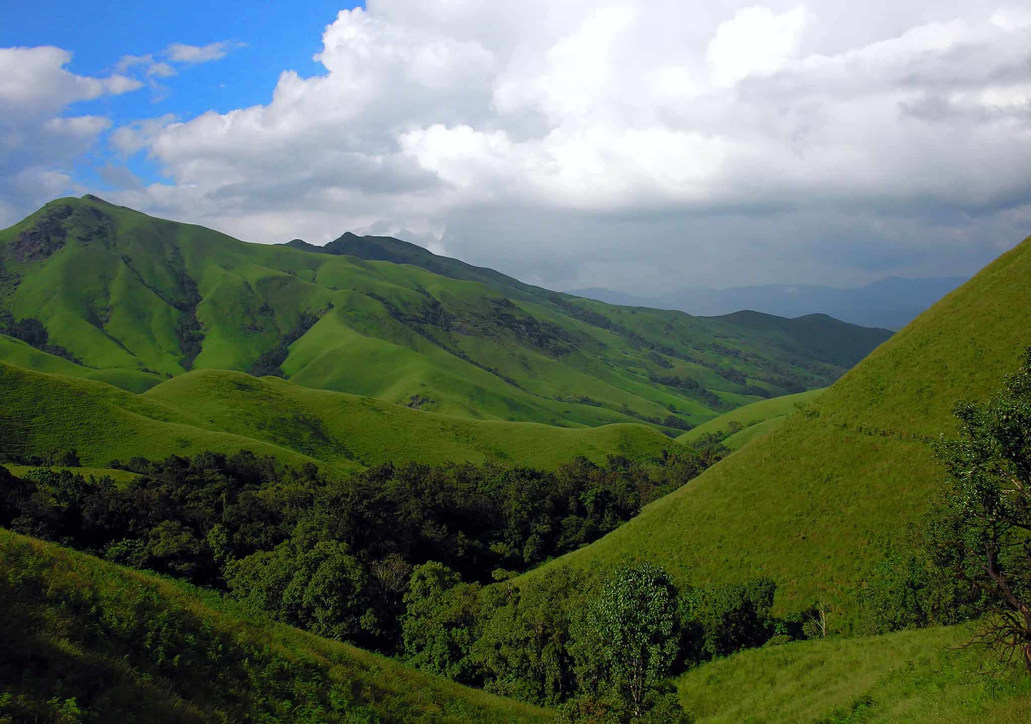
If one trek captures the visual romance of the Karnataka Ghats, it is Kudremukh, and it is deservedly one of the state’s signature trekking landscapes. Karnataka Tourism places the peak at 1,892 metres, while the national park describes a broader protected area of 600.57 sq km and highlights trekking, birdwatching and biodiversity as core draws.
The trek can be around 18 to 20 km in a round trip, usually starting near Mullodi and unfolding in recognisable stages: a forested opening, a steeper middle section, and then the airy ridge-and-grassland movement that gives Kudremukh its reputation. It is generally graded moderate to challenging because it is long and steadily demanding. You need stamina more than nerve. Even if the trek is not very technical, the fatigue accumulates quickly, and as is common for many longer treks, it is the will and mettle that decides how the trek will treat you.
That effort is repaid in one of the Western Ghats’ most complete trekking landscapes. Forest shade, stream crossings, open meadows and broad horizons all appear in a single route; the feeling of walking across waves of grass with cloud-shadow running over them is somewhat unforgettable. Kudremukh is the sort of trail that explains, in physical terms, why the phrase “shola-grassland mosaic” matters in the Western Ghats.
Access here is controlled, and rightly so. Karnataka Forest Department permits are required through the Aranya Vihaara system, and trek-planning guides based on the current portal note advance booking windows, seasonal openings and daily quotas. That managed access reflects the ecological sensitivity of the landscape rather than bureaucracy for its own sake. This is a national park first, a trekking venue second.
The wildlife context is especially rich. Kudremukh National Park notes over 200 bird species, including the Malabar whistling thrush and great pied hornbill, while Karnataka Tourism lists mammals such as leopard, gaur, sambar, wild dog, sloth bear and Malabar giant squirrel in the wider park landscape. Few trekkers will see many of these animals on a busy day route, but the knowledge matters. It changes how the place is read. The silence here is inhabited.
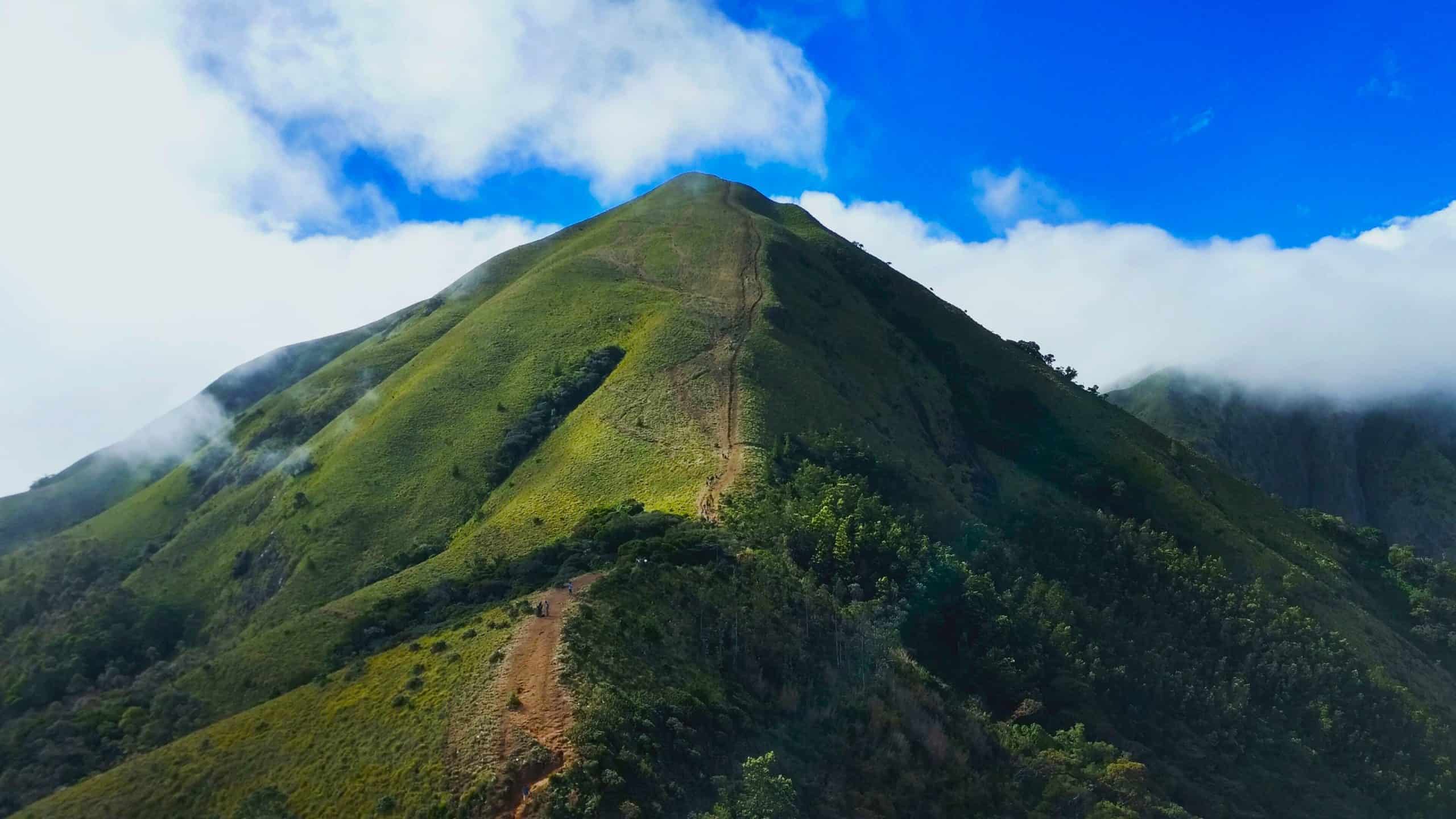
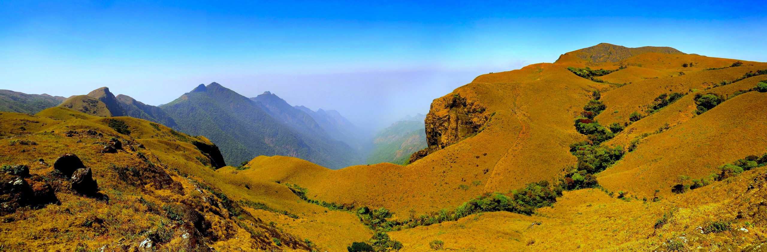
Meesapulimala: the high-range dream
Meesapulimala belongs to the southern high ranges near Munnar and is one of the most evocative mountain walks in the Western Ghats. Kerala Tourism calls it the second-highest peak in the Western Ghats after Anamudi and positions the trek through Rhodo Valley as one of Munnar’s major ecotourism experiences. This is a trek of rolling grasslands, shola pockets, long skyline movement and cool air that feels very different from the thicker forests further north.
Meesapulimala is usually treated as a moderate trek, often around 15 km round trip, though exact timing depends on where your jeep-supported access ends and how the package is structured. The trek is tied to guided ecotourism formats, often with overnight options at Rhodo Valley or other KFDC stays. That gives the route a curated, low-volume feel. You are not simply turning up at a trailhead and marching off. You are entering a managed high-range landscape.
Physically, Meesapulimala is less punishing than its reputation sometimes suggests, but it still asks for fitness. The trail rolls, rises, and repeats itself over a sequence of humps before the summit zone, and the thin sense of exposure in the open grasslands can make the day feel bigger than the numbers imply. Still, it is a beautiful rather than brutal trek. The reward is continuity of view: a whole procession of hills, skies and light rather than one sudden summit reveal.
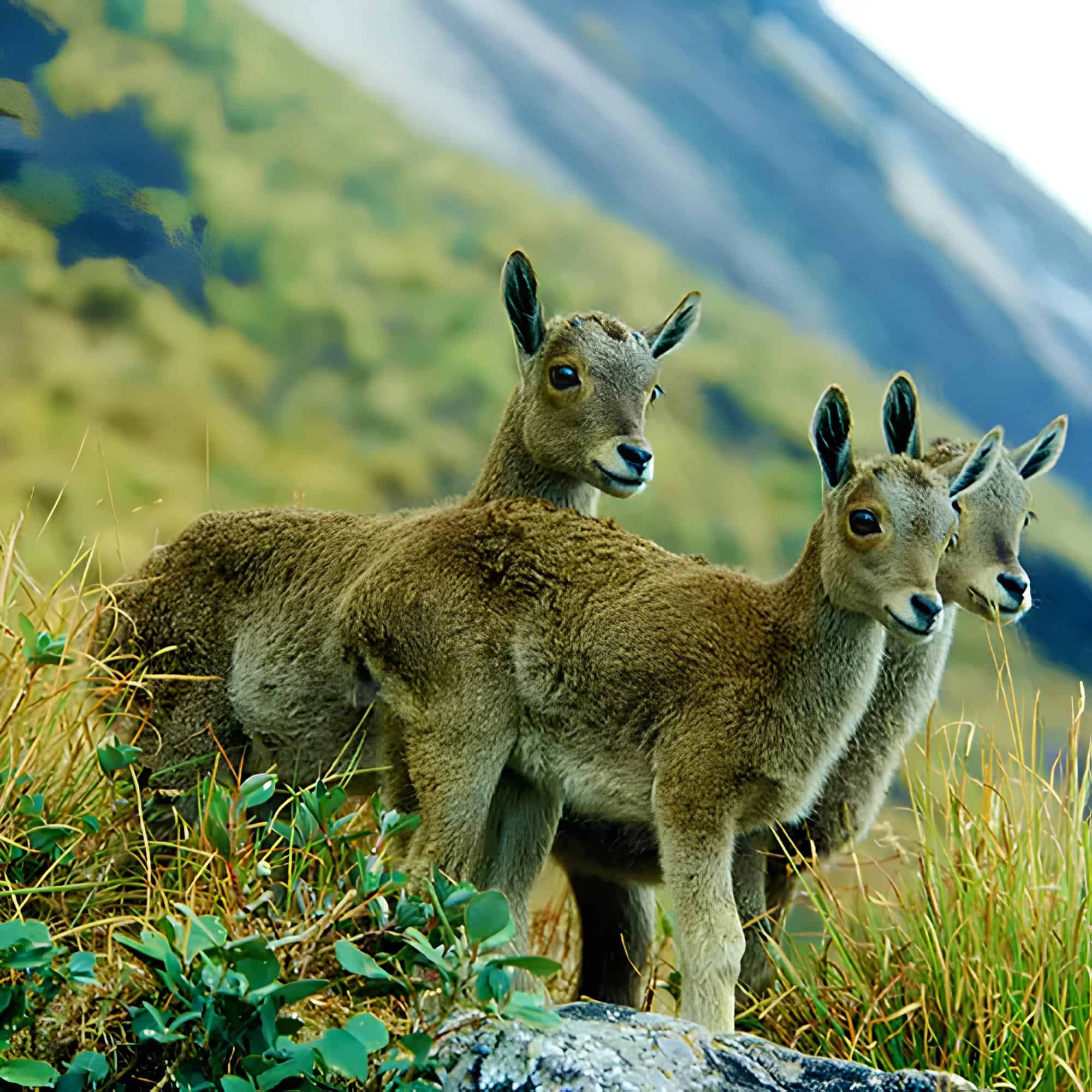
Its wildlife richness lies in the wider Munnar–Eravikulam high-range ecosystem. Kerala Tourism notes that Eravikulam National Park holds the largest surviving population and highest density of the Nilgiri tahr, and its avian pages list species such as the Nilgiri pipit, Nilgiri wood pigeon, Kerala laughingthrush, Nilgiri verditer flycatcher, and black-and-orange flycatcher. Not all of these are guaranteed on the trek itself, but Meesapulimala passes through the same high-altitude ecological world. That gives the mountain a biological gravity that goes far beyond pretty views.
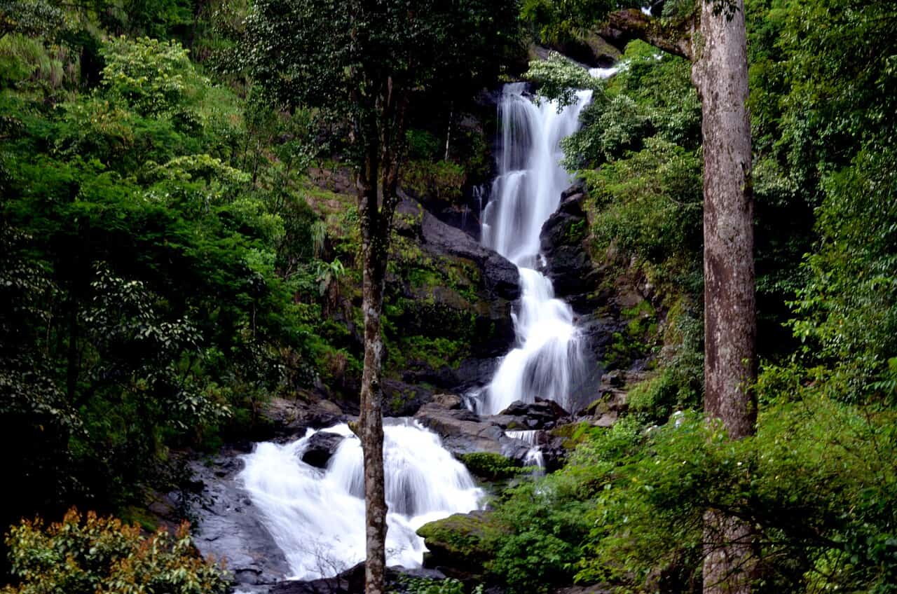
Andharban: the dark forest of Maharashtra
Andharban is unique among all the treks here; it offers no summit prestige, no famous high-range skyline and no single viewpoint that defines the day. Instead, there is the forest, dark, deep and teeming with life. What makes the Sahyadri trek unique is the fact that the trail descends into the forest, pushing through dense overgrowth with views of valleys and waterfalls breaking through only in intervals. If Kudremukh is a ridge walk and Meesapulimala a high-range ramble, Andharban is immersion.
Andharban’s route length can be placed at around 13 km, with a walking time that can range from 4–5 hours in easier conditions to noticeably longer in heavy rain and slower groups.. Distance matters here, but so do surface conditions. In the dry season, Andharban can feel like a beautiful, long forest traverse. In full monsoon, it becomes more demanding: slick rock, muddy sections, roaring streams, saturated vegetation and the constant need to watch your footing.
The trail’s great gift is mood. Valley views toward the Kundalika side appear and vanish. Clearings open onto waterfalls and then close again. The canopy can be so thick that even daylight feels filtered. This is where the Western Ghats feel humid, immediate and elemental. Andharban is not about conquering a peak. It is about staying inside a forest long enough for its textures to become the story.
It is also richer ecologically than many trekkers realise. The wider Tamhini Wildlife Sanctuary landscape supports 150 bird species, 72 butterfly species and 28 mammal species, according to recent sanctuary summaries, while published bird-community work recorded 164 bird species in the sanctuary. On the trail, that does not usually translate into dramatic mammal sightings. What you are more likely to notice are butterflies, wet-forest birds, frogs, insect life and the sheer density of monsoon habitat. That is plenty. Andharban is a reminder that some of the best wildlife experiences in the Ghats are made of attentiveness rather than spectacle.
For the Trekers
For most trekkers, the most reliable season across this set remains post-monsoon into winter, when the hills stay green, but the trails are less treacherous.
Monsoon, especially in places like Andharban, is visually magnificent but materially harder: slippery, leech-prone, and more sensitive to closures or access changes.
That final point may be the most important of all.
The Western Ghats are living mountains, not static products.
Trail rules change, wildlife moves, weather interrupts, and forest departments adjust access for good reason.
It is important to note how some of the most rewarding treks in the Western Ghats are restricted access or done with special permissions; these treks are part of the living heartbeats of the wild.
The best way to walk these hills is with respect for that fact, because it is precisely what keeps them worth walking.
Read More: Latest
